About the Big Radius Tool
We often get questions about how many people, industries, or workers there are within a 25 mile radius. This tool answers those questions for you.
The Big Radius Tool is intended to provide “gross” numbers for a mileage-based radius, beginning at 25 miles and going up to 500 miles. Counties are aggregated, so this isn’t a hyper-precise tool but is intended to provide intelligence on the counties within a large (25 miles or more) radius.
Use It to
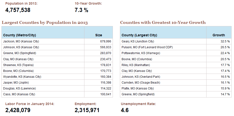
- Enumerate how many people live within a certain radius
- See which counties are the largest and/or the fastest growing
- Quickly learn the size of the labor force and unemployment rate ranges of the counties in the radius
- Determine which industry sectors are among the largest in the radius
How to Use It
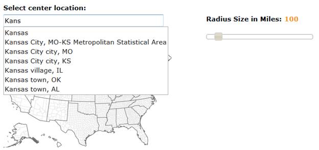
It’s easy—just type in the name of a city or county and use the “autofill” to choose the center point of the radius. Then use the slider to increase or decrease the radius (minimum is 25 miles).
Example Output
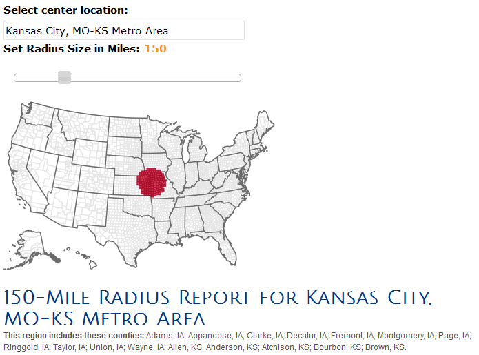
The example below is for an 150-mile radius with the Kansas City metro at the center.
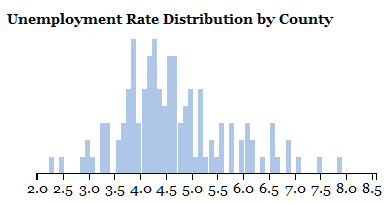
The chart below is clustering all of the counties that comprise the radius by the unemployment rate, providing insight into how much of the radius has higher or lower unemployment and perhaps providing insight into worker availability.
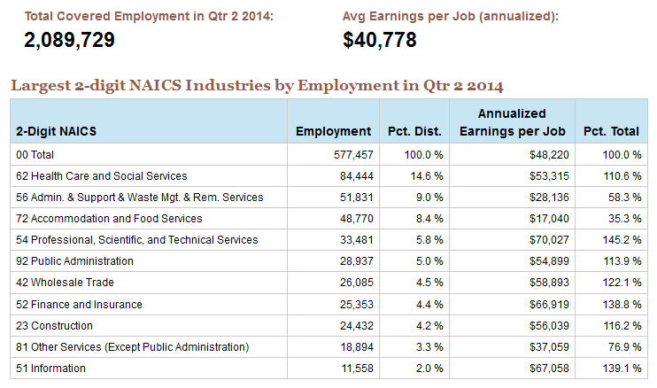
And the final table provided shows the largest employing sectors of the economy in the radius a user selects.
MetaFacts
| Sources:
|
- U.S. Census Bureau, Annual Population Estimates
- U.S. Bureau of Labor Statistics, Local Areal Unemployment Statistics (LAUS) and Quarterly Census of Employment and Wages (QCEW)
- Indiana University, Kelley School of Business, Indiana Business Research Center retrieval algorithms and interface
|
| Geography:
| Counties are the building blocks for this “big” radius in large part because there is MUCH more data available at the county level. The center-point of the central county for the “place or metro or city” that a user types into the search box at the top of the tool is the starting point for the radius.
The radius is aggregated at the county-level within the radius, an important point to keep in mind. For radius information that is built from census blocks or ZIP codes, users can turn to GIS tools, such as Esri or other commercial products. |
| Frequency:
| The majority of the data are annual—except for the labor force, employed and unemployment figures, which are monthly. |